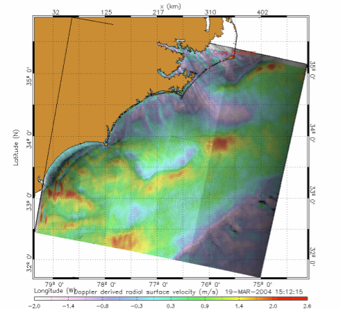
Satellite missions that measure surface velocities using Doppler radars are opening new perspectives for the monitoring and analysis of oceans, including sea ice, with a direct measurement of currents, winds and waves. From past and existing missions (Envisat, Sentinel 1) that are limited to a fixed line of sight component and sparse / partial coverage of the oceans, to future at different stages of planning and proposal (SKIM, WaCM, SEASTAR), a vast variety of instrument designs and signal processing steps are possible. This workshop will bring together instrument and processing experts with the ocean science community to address a wide range of topics that will feed into the processing and design of existing and future missions.
The exact nature of surface currents that such satellite missions aim at measuring will be exposed and discussed, especially their physical significance, the spatio-temporal scales coming into play or the possible synergy between satellite missions (Doppler radars with infrared and microwave SST, altimetry, ocean color, etc ...). Particular needs of surface velocity measurements will impact observational requirements, especially around tropical regions (upwellings, Madden-Julian oscillation, etc …), for mapping of the global mesoscale, for understanding the ocean energy cycle (wind work, role of near-inertial oscillations), air-sea fluxes, or the dynamics around ice edges. The workshop will also cover the use of surface currents data, including inversion algorithms, data-driven approaches, assimilation, model bias correction, etc …
